مڪران
| مڪران | |
|---|---|
| ھڪ علائقو | |
 مڪران جون ٽڪريون | |
| جاگرافي بيهڪ: | |
| ملڪ | پاڪستان ۽ ايران |
| صوبو | بلوچستان، پاڪستان |
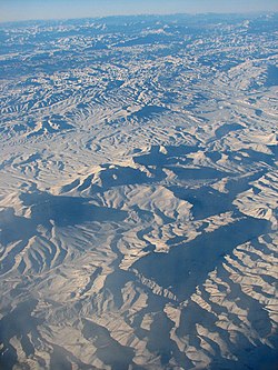
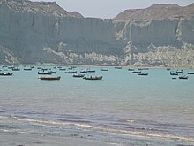
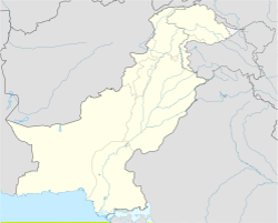
مڪران (Makran؛ اردو، فارسي:مکران)، بلوچستان جو ڏاکڻي ساحلي علائقو آهي. ھي ھڪ نيم ريگستاني ساحلي پٽي آھي جيڪو پاڪستان ۾ بلوچستان صوبي ۾ ۽ ايران ۾ عمان جي نار جي سامونڊي ڪناري سان آھي. اهو، سونمياڻي خليج کان اوڀر ۾ ڪراچي جي اتر اولهه ۾ ۽ اولهه طرف ايران جي سيستان ۽ بلوچستان صوبي جي ڏاکڻي حصي ۾ بشڪرديا (Bāšgerd) جي علائقي جي ڪناري تائين پکڙيل آهي. اهڙيءَ طرح مڪران کي پاڪستان ۽ ايران جي وچ ۾ جديد سياسي سرحدن ذريعي ورهايو ويو آهي. پاڪستان جي صوبي، بلوچستان جو جابلو علائقو آهي.[1][2]
نالو
[سنواريو]بلوچستان جي ڏاکڻي حصي کي پاڪستاني طرف ڪيچ مڪران ۽ ايراني پاسي مڪران سڏيو وڃي ٿو جيڪو پڻ اڳوڻي ايراني صوبي جو نالو آهي. اهو مقام قديم هخامنسي Achaemenid زماني ۾ ماکا ستراپي سان ملندو آهي. مگن جا سميري واپاري ساٿي مڪران سان سڃاڻن ٿا. وراهميهر جي برهت سميتا ۾، هندستان جي اولهه ۾ رهندڙ "مڪرا" نالي هڪ قبيلي جو ذڪر آهي. آريانوس ساحلي علائقن جي رهاڪن لاءِ اخٿائيوڦاگي (Ichthyophagi) (قديم يوناني:مڇي کائڻ وارا) لفظ استعمال ڪيو، جنهن جي نتيجي ۾ مڪران کي جديد فارسي اصطلاح ماهي خوران مان ڪڍڻ جو مشورو ڏنو ويو آهي، جنهن جي معنيٰ آهي ”مڇي کائڻ وارا“.
تاريخ
[سنواريو]See also:Kingdom of Makran.
ابتدائي آباديون
[سنواريو]ڪيچ مڪران جو علائقو ڏکڻ اولهه پاڪستان ۾ ڪيچ نديءَ جي ڪناري تي پنج صدي قبل مسيح ۾ آباد هو. ماري قلات جي ماڳ تي 1987ع کان 2007ع تائين فرانسيسي ۽ پاڪستاني آثار قديمه جي ماهرن تحقيق ڪئي، بعد ۾ تربت جي ڀرسان شاهي ٽمپ جي ماڳ جو پڻ مطالعو ڪيو ويو. 4000 قبل مسيح کان اڳ ئي وڏي ۽ وڏي چوڏهين پٿر جي عمارت تعمير ٿي چڪي هئي. آثار قديمه جي ماهرن کي رهاڪن پاران استعمال ڪيل پٿر، ڪم ٿيل پٿر ۽ هڏن جا اوزار مليا آهن، پر اڃا تائين ڪا به سيرامڪس استعمال نه ڪئي وئي هئي.
ان دور ۾ ڪيچ نديءَ جي وادي جا رهواسي اڳ ۾ ئي ڪڻڪ ۽ جَوَ ۽ مسور پوکيندا هئا. هنن وٽ ڍور ڍڳا، ٻڪريون ۽ رڍون هيون. اهي به عربي سمنڊ مان مڇيون پڪڙيندا هئا. مڪران II جي دور ۾، وڏي پيماني تي تعميراتي اڏاوتن جي تعمير جاري رهي ۽ هڪ چوٿين پٿر جو ڪمپليڪس تعمير ڪيو ويو. بعد ۾ انهن پٿرن جي عمارتن جي چوٽيءَ تي مٽيءَ جي سرن جون اڏاوتون پڻ نظر اچن ٿيون.
ماري قلات ۾ اُروڪ ڪلچر جي سرزمين سان به ڪجهه لاڳاپا مليا. بالاڪوٽ، مڪران سان لاڳاپيل ماڳ، جيڪو 4000 ق.م کان واپس وڃي ٿو، پڻ آثار قديمه جي ماهرن پاران اڀياس ڪيو ويو آهي.
قديم زمانو
موريا سلطنت جي يونانين خلاف سيليوسڊ-مورين جنگ ۾ فتح کانپوءِ، بلوچستان قديم هندستان جي چندرگپت موريا جي حڪومت هيٺ آيو. چندرگپت ۽ سيليوڪس 304 قبل مسيح ۾ صلح جو ٺاهه ڪيو. سيليوڪس اول، نڪاتور (Seleucus I Nicator) بلوچستان جا علائقا مورين جي حوالي ڪري ڇڏيا، جيڪا موري سلطنت جي توسيع ڪرڻ لڳا. اهو اتحاد چندرگپت موريا ۽ سليوسڊ سلطنت جي شهزادي جي وچ ۾ شادي سان مضبوط ٿيو. انتظام جو نتيجو باهمي طور تي فائدي وارو ثابت ٿيو. سليوسڊ ۽ موريا سلطنتن جي وچ ۾ سرحد ايندڙ نسلن ۾ مستحڪم رهي ۽ دوستانه سفارتي لاڳاپا سفير ميگاسٽينز ۽ چندر گپت جي پوٽي اشوڪ پاران اولهه طرف موڪليل سفيرن پاران ظاهر ڪيا ويا آهن.
ساساني سلطنت:
Earliest settlements::: The Kech-Makran region in southwestern Pakistan, along Kech River, was inhabited as early as the 5th millennium BCE. The site of Miri Qalat was investigated by French and Pakistani archaeologists from 1987 to 2007. Later, the site of Shahi-Tump, near Turbat, was also studied.[3]
Large and massive quadrangular stone building were constructed already before 4000 BCE. Flints, worked stones, and bone tools used by the inhabitants were found by archaeologists, but no ceramics were yet used.
In this Period I the inhabitants of the Kech River Valley already cultivated wheat and barley, as well as lentils. They had domesticated cattle, goats, and sheep. They also caught fish from the Oman Sea.
During Period II, the building of massive architectural structures continued, and a quadrangular stone complex was built. Later, mud brick constructions also appear on top of some of these stone buildings.[4]
At Miri Qalat, some links with Uruk culture ceramics were also found.[5]
The related site of Balakot, Makran, going back to 4000 BCE, was also studied by archaeologists.
Ancient times::: After the victory of the Mauryan Empire against the Greeks in the Seleucid–Mauryan war, Baluchistan came under the rule of Chandragupta Maurya of ancient India. Chandragupta and Seleucus made a peace settlement in 304 BCE. Seleucus I Nicator ceded the satrapies, including those in Baluchistan to the expanding Mauryan Empire.[6] The alliance was solidified with a marriage between Chandragupta Maurya and a princess of the Seleucid Empire. An outcome of the arrangement proved to be mutually beneficial.[6] The border between the Seleucid and Mauryan Empires remained stable in subsequent generations, and friendly diplomatic relations are reflected by the ambassador Megasthenes, and by the envoys sent westward by Chandragupta's grandson Ashoka.[6]
Sasanian Empire
[سنواريو]Shapur I's trilingual inscription at the Ka'ba-ye Zartosht in Naqsh-i-Rustam, dated to 262 CE, had noted "Makuran"/"Makran" to be one of the many provinces of the Sasanian Empire:

And I (Shapur I) possess the lands: Fars سانچو:Bracket, Pahlav سانچو:Bracket ... and all of Abarshahr (all the upper (eastern, Parthian) provinces), Kerman, Sakastan, Turgistan, Makuran, Pardan سانچو:Bracket, Hind سانچو:Bracket and Kushanshahr all the way to Pashkibur سانچو:Bracket and to the borders of Kashgaria, Sogdia and Chach سانچو:Bracket and of that sea-coast Mazonshahr سانچو:Bracket.
— Shapur I's inscription at the Ka'ba-ye Zartosht (262 CE), translation by Josef Wiesehöfer (1996).[7][8][9]
Buddhist and Hindu past
[سنواريو]Abū Rayḥān Muḥammad ibn Aḥmad Al-Bīrūnī states in his book Alberuni's India that the coast of India begins with Tiz, the capital of Makran.[10]
According to historian Andre Wink: سانچو:South Asia in 350 CE
Further evidence in the Chachnama makes perfectly clear that many areas of Makran as of Sindh had a largely Buddhist population. When Chach marched to Armabil, this town is described as having been in the hands of a Buddhist Samani (Samani Budda), a descendant of the agents of Rai Sahiras who had been elevated for their loyalty and devotion, but who later made themselves independent. The Buddhist chief offered his allegiance to Chach when the latter was on his way to Kirman in 631. The same chiefdom of Armadil is referred to by Hiuen Tsang O-tien-p-o-chi-lo, located at the high road running through Makran, and he also describes it as predominantly Buddhist, thinly populated though it was, it had no less than 80 Buddhist convents with about 5000 monks. In effect at eighteen km northwest of Las Bela at Gandakahar, near the ruins of an ancient town are the caves of Gondrani, and as their constructions show these caves were undoubtedly Buddhist. Traveling through the Kij valley further west (then under the government of Persia) Hiuen Tsang saw some 100 Buddhist monasteries and 6000 priests. He also saw several hundred Deva temples in this part of Makran, and in the town of Su-nu li-chi-shi-fa-lo – which is probably Qasrqand – he saw a temple of Maheshvara Deva, richly adorned and sculptured. There is thus very wide extension of Indian cultural forms in Makran in the seventh century, even in the period when it fell under Persian sovereignty. By comparison in more recent times the last place of Hindu pilgrimage in Makran was Hinglaj, 256 km west of present-day Karachi in Las Bela.[11]
Wink has recorded Hiuen Tsang's notes on the language and script in use in easternmost Makran (eastern parts of Pakistani Balochistan and Sindh):

Hiuen Tsang considered the script which was in use in Makran to be "much the same as India", but the spoken language "differed a little from that of India".[12]
Early medieval times
[سنواريو]The Hindu Sewa dynasty ruled much of Baluchistan up until the 7th century CE. The Sibi division carved out of Quetta division still derives its name from Rani Sewi, the queen of the Hindu Sewa dynasty.[13]
In 635 or 636 CE, the Hindu Brahman dynasty of Sindh controlled parts of Balochistan.[14]
Islamic conquest
[سنواريو]
The first Islamic conquest of Makran took place during the Rashidun Caliphate in the year 643 CE . Caliph Umar's governor of Bahrain, Usman ibn Abu al-Aas, who was on a campaign to conquer the southern coastal areas beyond Sassanid, sent his brother Hakam ibn Abu al-Aas to raid and reconnoitre the Makran region.[15]سانچو:Fcn
In late 644 CE Caliph Umar dispatched an army under the command of Hakam ibn Amr for the wholesale invasion of Makkuran. He was joined by reinforcements from Kufa under the command of Shahab ibn Makharaq, and by Abdullah ibn Utban, the commander of a campaign in Kerman. They encountered no strong resistance in Makran until the army of the King of Rai, along with contingents from Makran and Sind, stopped them near the Indus River. In mid-644 the Battle of Rasil was fought between the forces of the Rashidun Caliphate and the Rai Kingdom; the Raja's forces were defeated and forced to retreat to the eastern bank of the Indus. The Raja's army had included war elephants, but these had posed little problem for the Muslim invaders, who had dealt with them during the conquest of Persia. In accordance with the orders of Caliph Umar, the captured war elephants were sold in Islamic Persia, with the proceeds distributed among the soldiers as share in booty.[16] In response to Caliph Umar's questions about the Makran region, the messenger from Makkuran who brought the news of the victory told him:
Umar looked at the messenger and said: "Are you a messenger or a poet?" He replied, "Messenger". Thereupon Caliph Umar instructed Hakim bin Amr al Taghlabi that for the time being Makkuran should be the easternmost frontier of the Islamic empire, and that no further attempt should be made to extend the conquests.
It was reconquered by the usurper Chach of Alor in 631. Ten years later, it was described to be "under the government of Persia" by Xuanzang who visited the region. Three years later however, when the Arabs invaded, it was regarded as the "frontier of Al-Hind".[17] The Brahmin King of Sindh, Maharaja Chacha met the invaders outside Broach and defeated them with heavy slaughter also killing their very Commander-in-Chief Abdul Aziz in the process.[18][19]
Baloch attack on Mahmud Ghazni
[سنواريو]Baloch raiders plundered Mahmud of Ghazni's ambassador between Tabbas and Khabis. In revenge, his son Masud defeated them at the latter place, which lies at the foot of the Karman Mountains on the edge of the desert. [20]
Modern era
[سنواريو]
From the 15th century onward, the area was ruled by the Rind, Buledai, and Gichki.
The sultanate held onto the Makran coast throughout the period of British colonial rule, but eventually, only Gwadar was left in the hands of the sultan.
Princely State of Makaran
[سنواريو]On the independence of Pakistan, Makran became a district within the province of Balochistan, with the exception of an area of 800 km2 (310 sq mi) around Gwadar. Makran (اردو: ریاست مکران) was an autonomous princely state in a subsidiary alliance with British India until 1947, before acceding to Pakistan as an autonomous princely state of Pakistan.[21] It ceased to exist in 1955. It was located in the extreme southwest of present-day Pakistan, an area now parts of the districts of Gwadar, Kech and Panjgur. The state did not include the enclave of Omani Gwadar, which was under Omani rule until 1958.
Makran state was ruled by Gichki Nawabs,[22] who were of Rajputs origins.[23][24] Their ancestor, Jagat Singh had migrated from Rajputana in the 17th century and became Muslim. In 1958 the Gwadar enclave was transferred to Pakistani control as part of the district of Makran. The entire region has been subdivided into new smaller districts over the years. جنت السنڌ م لکيل آهي تہ؛
"مڪران هونئن ته وڏو علائقو هو، پر سندس ڪيچ مڪران واري حصي تي عيسيٰ بن معدان حڪومت ڪندو هو. سندس تختگاه ڪنزپور هو، جنهن تي عربن ’قنزبون‘ نالو رکيو هو، ان جا ڦٽل نشانو هاڻوڪي پنجگور شهر جي ويجهو آهن.[25] قنزبون وسعت ۾ ملتان جيڏو هو. هتي جو کجور جو حلوو قانيذ هينئر به مشهور آهي. هتي ڪرم آباد (خرم آباد) مکيه شهر آهي، جو هينئر البت ويران آهي، اڳ مردم خيز شهر هو ۽ باغات ڪري مشهور هو. سلطان مسعود سڄي مڪران تي قبضو ڪيو هو."[26]
جاگرافي
[سنواريو]
ورھاست
[سنواريو]مڪراڻ ٻن حصن ۾ ورھايل آھي؛
- پاڪستاني مڪراڻ
- ايراني مڪراڻ
پاڪستاني مڪراڻ
[سنواريو]
علائقي مڪراڻ جو وڏو حصو پاڪستان جي صوبي بلوچستان ۾ واقع آھي، جيڪو 25 ھزار چورس ميل ۽ تقريباً 6 لک جي آبادي تي مشتمل آھي. ھن جو صدر مقام تربت، ڪيچ آھي. ٻين شھرن ۾ گوادر ۽ پنجگور شامل آھن.
ايراني مڪراڻ
[سنواريو]مڪراڻ جو ڪجهه حصو ایران جي صوبي، سيستان و بلوچستان ۾ واقع آھي، جيڪو 22 ھزار چورس ميل ۽ تقريباً 5 لک جي آبادي تي مشتمل آھي. ھن جي وڏن شھرن ۾ چابھار، ايرانشھر، ديزڪ (سراوان)، سرباز، نيڪشھر ۽ بشگرد شامل آھن.
پڻ ڏسو
[سنواريو]حوالا
[سنواريو]- ↑ Makran - the makran coast - Dost Pakistan, وقت 2016-03-22 تي اصل کان آرڪائيو ٿيل, حاصل ڪيل 2018-10-05
- ↑ Himalayan Holidays Pakistan ... (Geography - Baluchistan / The Makran Coast Page), وقت 2016-10-24 تي اصل کان آرڪائيو ٿيل, حاصل ڪيل 2018-10-05
- ↑ Aurore Didier, Benjamin Mutin (2015). "The Kech-Makran region in Protohistoric Times" آرڪائيو ڪيا ويا 2022-04-03 حوالو موجود آهي وي بيڪ مشين.. In Ute Franke; Elisa Cortesi. Lost and Found: Prehistoric Pottery Treasures from Baluchistan. SMB. pp. 297–333. ISBN 978-3-00-051309-1.
- ↑ Aurore Didier, Benjamin Mutin (2015). "The Kech-Makran region in Protohistoric Times". In Ute Franke; Elisa Cortesi. Lost and Found: Prehistoric Pottery Treasures from Baluchistan. SMB. pp. 297–333. ISBN 978-3-00-051309-1.
- ↑ Van De Mieroop, M. (2008). A history of the ancient Near East. Malden, Massachusetts: Blackwell.
- ↑ 6.0 6.1 6.2 Kosmin 201433–34.
- ↑ The complete paragraph goes:
"And I [Shapur I] possess the lands: Fars [Persis], Pahlav [Parthia], Huzestan [Khuzistan], Meshan [Maishan, Mesene], Asorestan [Mesopotamia], Nod-Ardakhshiragan [Adiabene], Arbayestan [Arabia], Adurbadagan [Atropatene], Armen [Armenia], Virozan [Iberia], Segan [Machelonia], Arran [Albania], Balasagan up to the Caucasus and to the 'gate of the Alans' and all of Padishkhvar[gar] [the entire Elburz chain = Tabaristan and Gelan (?)], Mad [Media], Gurgan [Hyrcania], Marv [Margiana], Harey [Aria], and all of Abarshahr [all the upper (= eastern, Parthian) provinces], Kerman [Kirman], Sakastan, Turgistan, Makuran, Pardan [Paradene], Hind [Sind] and Kushanshahr all the way to Pashkibur [Peshawar?] and to the borders of Kashgaria, Sogdia and Chach [Tashkent] and of that sea-coast Mazonshahr ['Oman']."
in Wiesehöfer, Josef (1996). Ancient Persia : from 550 BC to 650 AD. London: I.B. Tauris. p. 184. ISBN 978-1860646751. - ↑ For a secondary source see Kia, Mehrdad (27 June 2016) (en ۾). The Persian Empire: A Historical Encyclopedia [2 volumes: A Historical Encyclopedia]. ABC-CLIO. p. 67. ISBN 978-1-61069-391-2. https://books.google.com/books?id=B5BHDAAAQBAJ&pg=PA67.
- ↑ For another referenced translation, visible online, see: Frye, Richard Nelson (1984) (en ۾). The History of Ancient Iran. C.H.Beck. p. 371. ISBN 978-3-406-09397-5. https://books.google.com/books?id=0y1jeSqbHLwC&pg=PA371.
- ↑ Bīrūnī, Muḥammad ibn Aḥmad (about A.D. 1030). Alberuni's India. 1. London: Trübner, 1888. p. 208. https://archive.org/details/alberunisindiaac01brnm/page/208/mode/1up?view=theater. Retrieved 2024-07-21.
- ↑ André Wink, Al-Hind: Early medieval India and the expansion of Islam, 7th–11th centuries, p. 135
- ↑ André Wink, Al-Hind: Early medieval India and the expansion of Islam, 7th–11th centuries, p. 137
- ↑ Syed Abdul Quddus, The tribal Baluchistan, p. 49
- ↑ Skutsch, Carl, ed (2005). Encyclopedia of the World's Minorities. New York: Routledge. pp. 178. ISBN 1-57958-468-3.
- ↑ Al Baldiah wal nahaiyah vol: 7 page 141
- ↑ Tarikh al Tabri, vol: 4 page no: 180
- ↑ Al-Hind, the Making of the Indo-Islamic World: Early Medieval India and the Expansion of Islam 7th–11th Centuries. Brill. 2002. pp. 131–132, 136. ISBN 0391041738. https://books.google.com/books?id=g2m7_R5P2oAC&pg=PA136.
- ↑ Savarkar, Veer (2020-01-01) (en ۾). Six Glorious Epochs of Indian History. Prabhat Prakashan. ISBN 978-93-5322-097-6. https://books.google.com/books?id=IajTDwAAQBAJ&dq=usman+the+governor+of+oman&pg=PT151.
- ↑ Munshi, Kanaiyalal Maneklal (1944) (en ۾). The Glory that was Gūrjaradeśa: The Imperial Gūrjaras. 1st ed. Bharatiya Vidya Bhavan. https://books.google.com/books?id=gfAdAAAAMAAJ&q=usman+the+governor+of+oman.
- ↑ Denzil Ibbetson, Edward MacLagan, H. A. Rose (1911). A Glossary of The Tribes & Casts of The Punjab & North-West Frontier Province. Vol. II. p. 43.
- ↑ Pillalamarri, Akhilesh. "A Brief History of Balochistan". The Diplomat. وقت 2024-04-01 تي اصل کان آرڪائيو ٿيل. حاصل ڪيل 2024-03-13. Unknown parameter
|url-status=ignored (مدد) - ↑ Malik, Fida Hussain (2020-10-14) (en ۾). Balochistan: A Conflict of Narratives. Saiyid Books. p. 11. ISBN 978-969-2200-02-8. https://books.google.com/books?id=VNwCEAAAQBAJ&pg=PA11. Retrieved 2024-03-13.
- ↑ Quddus, Syed Abdul (1990) (en ۾). The Tribal Baluchistan. Ferozsons. p. 63. ISBN 978-969-0-10047-4. https://books.google.com/books?id=FgFuAAAAMAAJ. "The former rulers of Makran and Lasbela, Gichki and Jamots respectively, are Rajputs."
- ↑ Spooner, Brian (1964). "Kūch u Balūch and Ichthyophagi". Iran 2: 53–67. doi:. ISSN 0578-6967. https://www.jstor.org/stable/4299552. Retrieved 2024-03-13. "The Gichki are the descendants of a Rajput family which settled in 17th century.".
- ↑ R. Hughes-Buller: Makran, Punjgur Valley, P-306. T.H. Boldich SIR: The Gales of India, Makran.
- ↑ ڪتاب جو نالو؛ "جنت السنڌ"، تصنيف: رحيمداد خان مولائي شيدائي، ايڊيشن: پهريون 2000ع، ٻيون 2006ع، ڇپائيندڙ: سنڌيڪا اڪيڊمي ڪراچي.


