شگر: جي ورجائن ۾ تفاوت
Intisar Ali (بحث | ڀاڱيداريون) نئون صفحو: {{Infobox settlement | name = Shigar | official_name = | native_name = {{lang|ur|{{Nq|شگر}}}}<!-- for citi... ٽيگَ: موبائل سنوار موبائل ويب سنوار |
(ڪو بہ تفاوت ڪونھي)
|
ورجاءُ بمطابق 21:40, 8 سيپٽمبر 2018ع
| Shigar شگر | |
|---|---|
| Town | |
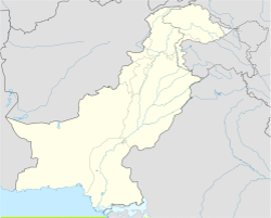
 Shigar, Skardu, Gilgit Baltistan | |
| قراقرم جي علائقي ۾ مقام | |
| جاگرافي بيهڪ: 35°25′25″N 75°44′20″E / 35.42361°N 75.73889°E | |
| ملڪ | |
| انتظامي صوبو | گلگت بلتستان |
| ضلعو | اسڪردو ضلعو |
| بلندي | 2,230 ميل (7,320 ft) |
| آبادي | |


[[File:Bhasha Vall ey, Shigar.jpg|thum |شگر ڀاشا وادي روڊ ]]


Shigar (اردو: شگر) is a district in the Baltistan division of Gilgit–Baltistan in the north of Skardu in northern Pakistan. The Shigar River, bisecting the Shigar valley, falls in the Indus River at Skardu city. The town is a popular site for tourists and trekkers and contains many historical buildings of architectural significance associated with the all communities. The town is inhabited 100% by Balti people of Tibetan descent. Almost 95% people belongs to Shia sect of Islam and the remaining belongs to the Sunni and the Norbakshi sects. It is the gateway to great mountain range of Karakorum including where 5 Eight-thousanders of the world falls, including the K2 . The valley is very fertile and rich in fruits including apples, cherries, apricots, pears and walnuts.[1]

Popular historical tourist sites in the town include:
- Shigar Fort
- Amburik Mosque
- Khilingrong Mosque
- Khanqah e Muallah Shigar
- Hashoo pi Bhag
- Marapi Ranga
- Ree masjid
- K2 Basecamp
- Astana of Syed Mir Yahya
- Khureed Ranga Gulabpur
- Choutran (Garam Chasma)
- Ticho Ranga Gulabpur
- Khanqa
- ↑ "Archived copy". وقت 10 January 2015 تي اصل کان آرڪائيو ٿيل. حاصل ڪيل 9 January 2015.


