
فائل:Arabian Peninsula dust SeaWiFS.jpg

هن پيش-نگاھ جي ماپ: 657*600 پڪزلس. ٻيا تحلل:263*240 پڪزلس | 526*480 پڪزلس | 841*768 پڪزلس | 1,122*1,024 پڪزلس | 2,504*2,286 پڪزلس
اصلوڪو فائيل (2,504 × 2,286 عڪسلون، فائيل سائيز: 853 KB، MIME ٽائيپ: image/jpeg)
| تشريح |
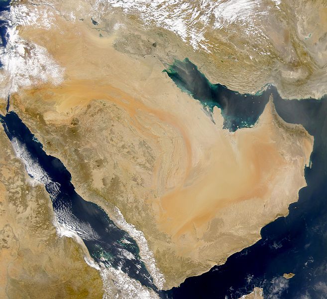
English: SeaWiFS collected this view of Arabia and of dust blowing across the Persian Gulf.
Español: La Península Arábiga vista desde el espacio |
| تاريخ | Taken on 2 مارچ 2000 |
| ذريعو | http://visibleearth.nasa.gov/view_rec.php?id=898 |
| ليکڪ | SeaWiFS Project, NASA/Goddard Space Flight Center, and ORBIMAGE |
| Other versions |
Derivative works of this file: |
| This image is from the Sea-viewing Wide Field-of-view Sensor (SeaWiFS) Project and more than 5 years old.
Satellite data captured by the SeaWIFS sensor are released into the public domain 5 years after capture. Data less than five years old can be re-used only for educational or scientific purposes; any commercial use of such images must be coordinated with GeoEye. [1] |
| This work has been released into the public domain by its copyright holder, GeoEye. This applies worldwide. In some countries this may not be legally possible; if so: GeoEye grants anyone the right to use this work for any purpose, without any conditions, unless such conditions are required by law.
|
Original upload log
The original description page was here. All following user names refer to commons.wikimedia.
- 2007-12-17 19:34 Hautala 2,504×2,286 (853000 bytes) {{PD-USGov-NASA}} Taken from NASA's Visible Earth, http://visibleearth.nasa.gov/
فائيل جي سوانح
ڪنھن بہ تاريخ/وقت تي ٽڙڪ ڪري ڏسندا تہ ان وقت اهو فائيل ڪيئن هو.
| تاريخ/وقت | آڱوٺي ننھن | ماپَ | واپرائيندڙ | راءِ | |
|---|---|---|---|---|---|
| موجود نسخو | 17:02, 2 جنوري 2008 | | 2,504 × 2,286 (853 KB) | Hautala | {{PD-USGov-NASA}} * {{en|Satellite image of Arabian peninsula}} * {{es|La Península Arábiga vista desde el espacio}} * {{en|Satelliittikuva Arabian niemimaasta}} Taken from NASA's [http://visibleearth.nasa.gov/ Visible Earth], from the page [http://v |
ڳنڍڻا
هن فائيل سان هيٺيان صفحا ڳنڍيل آهن.
گلوبل فائيل جو استعمال
ھيٺيون وڪيز بہ ھيءُ فائيل استعمال ڪن ٿيون:
- af.wikipedia.org تي استعمال
- als.wikipedia.org تي استعمال
- arc.wikipedia.org تي استعمال
- ar.wikipedia.org تي استعمال
- سلطنة عمان
- اليمن
- قطر
- الكويت
- البحرين
- تاريخ السعودية
- شبه الجزيرة العربية
- تاريخ البحرين
- تاريخ اليمن
- تاريخ الكويت
- يهود اليمن
- ويكيبيديا:صناديق المستخدم/تاريخ
- قالب:تاريخ شبه الجزيرة العربية
- بوابة:الكويت
- تاريخ الإمارات العربية المتحدة
- مستخدم:Ali alomary
- بنو قينقاع
- تاريخ اليمن القديم
- بنو قريظة
- تاريخ قطر
- السعودية
- خط زمني لتاريخ اليمن
- تاريخ اليمن الحديث
- تاريخ اليمن الإسلامي
- مستخدم:SHOBAR
- الإمارات العربية المتحدة
- قالب:شبه الجزيرة العربية
- بنو النضير
- بوابة:البحرين
- بوابة:البحرين/قوالب
- مستخدم:Sayom
- مستخدم:سلمان القحطاني
- مستخدم:Ramses Nagib
- مستخدم:Aabuhaimed
- جيولوجيا السعودية
- يهود حبان
- يهود حضرموت
- مستخدم:Marco 2 en
- مستخدم:((55الغيثي55))/ملعب
- مستخدم:((55الغيثي55))
- بوابة:الكويت/قوالب
- مستخدم:مخنف
- مستخدم:Nedz3r
- مستخدم:Ikhlas Qassmi 13336
- مستخدم:بو خالد الجش
ھن فائيل جو وڌيڪ گلوبل استعمال ڏسو.