
فائل:Pakistan tehsils.svg

Size of this PNG preview of this SVG file: 512*279 پڪزلس. ٻيا تحلل:320*174 پڪزلس | 640*349 پڪزلس | 1,024*558 پڪزلس | 1,280*698 پڪزلس | 2,560*1,395 پڪزلس
اصلوڪو فائيل (ايسويجي فائيل، اٽڪل 512 × 279 عڪسلون، فائيل سائيز: 940 KB)
تَتُ
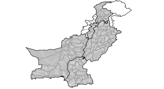
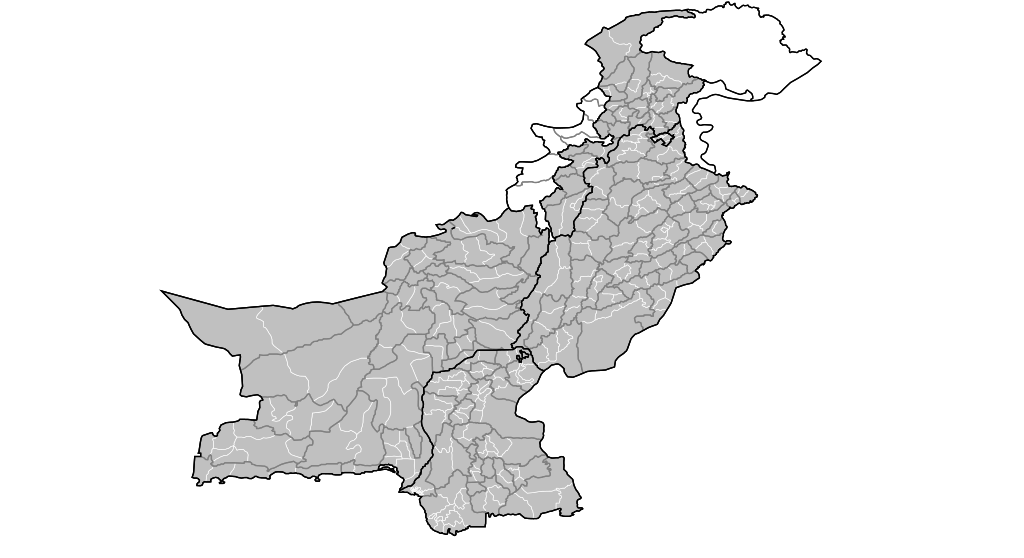
| تشريح | Map of the tehsils of Pakistan. Map includes the disputed areas. Created by Rarelibra 20:47, 31 October 2007 (UTC) for public domain use, using MapInfo Professional v8.5 and various mapping resources. |
| تاريخ | 31 آڪٽوبر 2007 (original upload date) |
| ذريعو | No machine-readable source provided. Own work assumed (based on copyright claims). |
| ليکڪ | No machine-readable author provided. Rarelibra assumed (based on copyright claims). |
لائيسنسڪاري
| I, the copyright holder of this work, release this work into the public domain. This applies worldwide. In some countries this may not be legally possible; if so: I grant anyone the right to use this work for any purpose, without any conditions, unless such conditions are required by law. |
فائيل جي سوانح
ڪنھن بہ تاريخ/وقت تي ٽڙڪ ڪري ڏسندا تہ ان وقت اهو فائيل ڪيئن هو.
| تاريخ/وقت | آڱوٺي ننھن | ماپَ | واپرائيندڙ | راءِ | |
|---|---|---|---|---|---|
| موجود نسخو | 20:47, 31 آڪٽوبر 2007 | | 512 × 279 (940 KB) | Rarelibra | Map of the tehsils of Pakistan. Map includes the disputed areas. Created by ~~~~ for public domain use, using MapInfo Professional v8.5 and various mapping resources. |
ڳنڍڻا
ڪي بہ صفحا ناھن جيڪي ھن فائيل کي استعمال ڪندا ھجن.
گلوبل فائيل جو استعمال
ھيٺيون وڪيز بہ ھيءُ فائيل استعمال ڪن ٿيون:
- ar.wikipedia.org تي استعمال
- ckb.wikipedia.org تي استعمال