
فائل:Oil Rocks estacades.jpg

هن پيش-نگاھ جي ماپ: 800*449 پڪزلس. ٻيا تحلل:320*180 پڪزلس | 640*359 پڪزلس | 1,024*575 پڪزلس | 1,280*718 پڪزلس | 3,264*1,832 پڪزلس
اصلوڪو فائيل (3,264 × 1,832 عڪسلون، فائيل سائيز: 766 KB، MIME ٽائيپ: image/jpeg)
| تشريح |
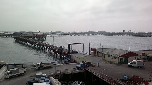
English: Oil Rocks platform in Caspian Sea (Azerbaijan sector) |
| تاريخ | |
| ذريعو | ڪم پنھنجايو |
| ليکڪ | Interfase |
| Camera location | | View this and other nearby images on: OpenStreetMap |
|---|
| I, the copyright holder of this work, release this work into the public domain. This applies worldwide. In some countries this may not be legally possible; if so: I grant anyone the right to use this work for any purpose, without any conditions, unless such conditions are required by law. |
فائيل جي سوانح
ڪنھن بہ تاريخ/وقت تي ٽڙڪ ڪري ڏسندا تہ ان وقت اهو فائيل ڪيئن هو.
| تاريخ/وقت | آڱوٺي ننھن | ماپَ | واپرائيندڙ | راءِ | |
|---|---|---|---|---|---|
| موجود نسخو | 19:02, 1 مارچ 2012 | | 3,264 × 1,832 (766 KB) | Interfase | {{Information |Description ={{en|1=Oil Rocks platform in Caspian Sea (Azerbaijan sector)}} |Source ={{own}} |Author =Interfase |Date =2012-03-01 |Permission = |other_versions = }} {{PD-own}} Category:Neft Daşları ... |
ڳنڍڻا
هن فائيل سان هيٺيان صفحا ڳنڍيل آهن.
گلوبل فائيل جو استعمال
ھيٺيون وڪيز بہ ھيءُ فائيل استعمال ڪن ٿيون:
- az.wikipedia.org تي استعمال
- ba.wikipedia.org تي استعمال
- bg.wikipedia.org تي استعمال
- ce.wikipedia.org تي استعمال
- el.wikipedia.org تي استعمال
- en.wikipedia.org تي استعمال
- en.wikivoyage.org تي استعمال
- es.wikipedia.org تي استعمال
- fi.wikipedia.org تي استعمال
- fr.wikipedia.org تي استعمال
- ja.wikipedia.org تي استعمال
- ka.wikipedia.org تي استعمال
- nl.wikipedia.org تي استعمال
- pt.wikipedia.org تي استعمال
- ru.wikipedia.org تي استعمال
- uz.wikipedia.org تي استعمال
- www.wikidata.org تي استعمال