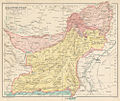
فائل:Map of Baluchistan from The Imperial Gazetteer of India (1907-1909).jpg
ڏيک

هن پيش-نگاھ جي ماپ: 710*599 پڪزلس. ٻيا تحلل:284*240 پڪزلس | 569*480 پڪزلس | 1,000*844 پڪزلس
اصلوڪو فائيل (1,000 × 844 عڪسلون، فائيل سائيز: 254 KB، MIME ٽائيپ: image/jpeg)
فائيل جي سوانح
ڪنھن بہ تاريخ/وقت تي ٽڙڪ ڪري ڏسندا تہ ان وقت اهو فائيل ڪيئن هو.
| تاريخ/وقت | ٽِڪِلِي | ماپَ | واپرائيندڙ | راءِ | |
|---|---|---|---|---|---|
| هاڻوڪو نسخو | 06:19, 8 آڪٽوبر 2014 |  | 1,000 × 844 (254 KB) | Co9man | User created page with UploadWizard |
ڳنڍڻا
هن فائيل سان هيٺيان صفحا ڳنڍيل آهن.
فائيل جو ٻين وڪيز تي استعمال
ھيٺيون وڪيز بہ ھيءُ فائيل استعمال ڪن ٿيون:
- bn.wikipedia.org تي استعمال
- ca.wikipedia.org تي استعمال
- de.wikipedia.org تي استعمال
- en.wikipedia.org تي استعمال
- es.wikipedia.org تي استعمال
- fa.wikipedia.org تي استعمال
- hi.wikipedia.org تي استعمال
- hu.wikipedia.org تي استعمال
- it.wikipedia.org تي استعمال
- mr.wikipedia.org تي استعمال
- pl.wikipedia.org تي استعمال
- ru.wikipedia.org تي استعمال
- ur.wikipedia.org تي استعمال

