
فائل:Island of Ireland location map Tipperary.svg

Size of this PNG preview of this SVG file: 481*599 پڪزلس. ٻيا تحلل:192*240 پڪزلس | 385*480 پڪزلس | 616*768 پڪزلس | 822*1,024 پڪزلس | 1,643*2,048 پڪزلس | 1,450*1,807 پڪزلس
اصلوڪو فائيل (ايسويجي فائيل، اٽڪل 1,450 × 1,807 عڪسلون، فائيل سائيز: 642 KB)
| تشريح |
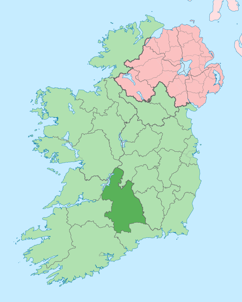
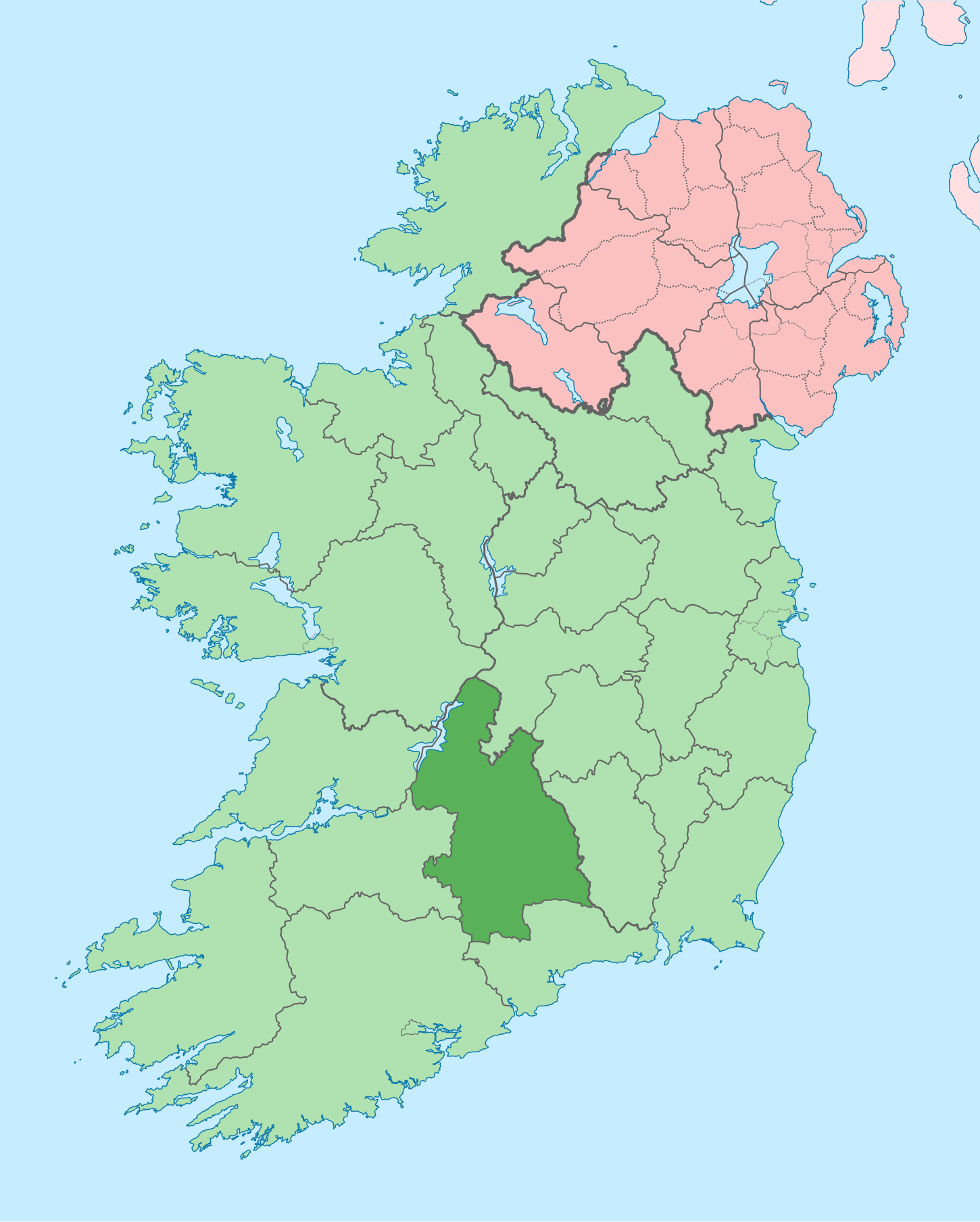
English: The island of Ireland, showing international border between Ireland and Northern Ireland, traditional provinces, traditional counties, and local authority areas in Ireland and Northern Ireland. |
| تاريخ | (UTC) |
| ذريعو | |
| ليکڪ |
|
| Other versions |
Derivative works of this file: |
| This is a retouched picture, which means that it has been digitally altered from its original version. Modifications: Coloured in regions with county of article highlighted. The original can be viewed here: Island of Ireland location map.svg:
|
I, the copyright holder of this work, hereby publish it under the following license:
ھي فائيل ڪريئيٽو ڪامنز انتساب-ھڪجھڙي ڀاڱيداري 3.0 انپورٽڊ اجازتنامي ھيٺ اجازتنامو ڏنل آھي.
- توھان آزاد آھيو:
- ونڊڻ لاءِ – اھو ڪم نقل ڪرڻ، ورڇڻ، ۽ پارمڪارڻ
- جڳلبندي ڪرڻ – ڪم اختيار ڪرڻ لاءِ
- ھيٺين شرطن تي:
- انتساب – توهان لازماً مناسب انتساب ڏيو، اجازتنامي ڏانھن ڳنڍڻو مھيا ڪريو، ۽ جيڪڏھن ڪي تبديليون ڪيون ويون ھجن تہ انھن جي نشاندھي ڪريو. توهان اهو ڪري سگهو ٿا ڪنھن بہ معقول طريقي سان، پر ڪنھن بہ اھڙي طريقي سان نہ جيڪو ڏسي تہ اجازتنامو ڏيندڙ توهان جي يا توهان جي استعمال جي توثيق ڪري ٿو.
- ھڪجھڙي ڀاڱيداري – جيڪڏھن توھان ٻيھر ملاوٽ، بدلاءُ، يا مواد تي اڏاوت ڪريو ٿا، توھان کي لازماً پنھنجون ڀاڱيداريون ساڳي يا موافق اجازتنامي جھڙو اصل جو ھيو، ھيٺ ٻيھر-ورھائڻ گهرجن.
Original upload log
This image is a derivative work of the following images:
- File:Island_of_Ireland_location_map.svg licensed with Cc-by-sa-3.0
- 2010-03-06T20:43:33Z Rannpháirtí anaithnid 1450x1807 (679207 Bytes) Fix incorrectly coloured isands.
- 2010-03-03T22:19:29Z Rannpháirtí anaithnid 1450x1807 (679744 Bytes) {{Information |Description={{de|Positionskarte von [[:de:Irland|Irland]]}} Quadratische Plattkarte, N-S-Streckung 170 %. Geographische Begrenzung der Karte: * N: 55.6° N * S: 51.2° N * W: 11.0° W * O: 5.0° W {{en|Location
Uploaded with derivativeFX
فائيل جي سوانح
ڪنھن بہ تاريخ/وقت تي ٽڙڪ ڪري ڏسندا تہ ان وقت اهو فائيل ڪيئن هو.
| تاريخ/وقت | آڱوٺي ننھن | ماپَ | واپرائيندڙ | راءِ | |
|---|---|---|---|---|---|
| موجود نسخو | 15:59, 26 جُونِ 2020 | | 1,450 × 1,807 (642 KB) | Chipmunkdavis | Per the Local Government Reform Act 2014, joining both Tipperarys and both Waterfords (and removing Limerick City code). Colouring in islands, cleaning up and grouping code to remove stray objects and show Galway and Lough Ree. |
| 01:03, 19 جُولاءِ 2010 |  | 1,450 × 1,807 (815 KB) | Mabuska | {{Information |Description={{en|The island of Ireland, showing international border between Northern Ireland and Republic of Ireland, traditional provinces, traditional counties, and local authority areas in the Republic of Ireland and Northern Ireland.}} |
ڳنڍڻا
هن فائيل سان هيٺيان صفحا ڳنڍيل آهن.
گلوبل فائيل جو استعمال
ھيٺيون وڪيز بہ ھيءُ فائيل استعمال ڪن ٿيون:
- ar.wikipedia.org تي استعمال
- ast.wikipedia.org تي استعمال
- bg.wikipedia.org تي استعمال
- ca.wikipedia.org تي استعمال
- cs.wikipedia.org تي استعمال
- de.wikivoyage.org تي استعمال
- en.wikipedia.org تي استعمال
- County Tipperary
- Thurles
- Cahir
- Nenagh
- Dromineer
- List of Ireland-related topics
- Clonmel
- Templemore
- Ballyporeen
- Roscrea
- Cashel, County Tipperary
- Carrick-on-Suir
- Ballingarry, South Tipperary
- Fethard, County Tipperary
- Silvermines
- Puckane
- Ardcroney
- Tipperary (town)
- Lisronagh
- Cloughjordan
- Ardfinnan
- Borrisokane
- Two-Mile Borris
- River Drish
- Terryglass
- Newport, County Tipperary
- Ballina, County Tipperary
- New Inn, County Tipperary
- Borrisoleigh
- Clare Glens
- Clogheen, County Tipperary
- Clonoulty
- Bansha
- Sugarloaf Hill (Knockmealdowns)
- Loughmore
- Castleiney
- Abbeville, Tipperary
- Emly
- Garranlea
- Lagganstown
- Dundrum, County Tipperary
ھن فائيل جو وڌيڪ گلوبل استعمال ڏسو.