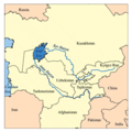
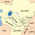
فائل:Aral map.png
Aral_map.png (279 × 281 عڪسلون، فائيل سائيز: 19 KB، MIME ٽائيپ: image/png)
فائيل جي سوانح
ڪنھن بہ تاريخ/وقت تي ٽڙڪ ڪري ڏسندا تہ ان وقت اهو فائيل ڪيئن هو.
| تاريخ/وقت | آڱوٺي ننھن | ماپَ | واپرائيندڙ | راءِ | |
|---|---|---|---|---|---|
| موجود نسخو | 17:41, 9 اپريل 2008 |  | 279 × 281 (19 KB) | Claus Obana | |
| 14:02, 22 جنوري 2007 |  | 300 × 300 (18 KB) | Kmusser | added label for Naryn River | |
| 18:52, 16 نومبر 2005 |  | 300 × 300 (16 KB) | Kmusser | ||
| 18:33, 16 نومبر 2005 |  | 300 × 300 (65 KB) | Kmusser | This is a map of area around the Aral Sea including the Amu Darya and Syr Darya rivers. I, Karl Musser, created it based on USGS data. The Aral Sea b |
ڳنڍڻا
هن فائيل سان هيٺيان صفحا ڳنڍيل آهن.
گلوبل فائيل جو استعمال
ھيٺيون وڪيز بہ ھيءُ فائيل استعمال ڪن ٿيون:
- af.wikipedia.org تي استعمال
- ar.wikipedia.org تي استعمال
- arz.wikipedia.org تي استعمال
- ast.wikipedia.org تي استعمال
- az.wikipedia.org تي استعمال
- ba.wikipedia.org تي استعمال
- be-tarask.wikipedia.org تي استعمال
- be.wikipedia.org تي استعمال
- bg.wikipedia.org تي استعمال
- br.wikipedia.org تي استعمال
- ca.wikipedia.org تي استعمال
- ceb.wikipedia.org تي استعمال
- cs.wikipedia.org تي استعمال
- cv.wikipedia.org تي استعمال
- cy.wikipedia.org تي استعمال
- da.wikipedia.org تي استعمال
- de.wikipedia.org تي استعمال
- diq.wikipedia.org تي استعمال
- el.wikipedia.org تي استعمال
- en.wikipedia.org تي استعمال
- en.wiktionary.org تي استعمال
- eo.wikipedia.org تي استعمال
- es.wikipedia.org تي استعمال
- eu.wikipedia.org تي استعمال
- fa.wikipedia.org تي استعمال
- fi.wikipedia.org تي استعمال
ھن فائيل جو وڌيڪ گلوبل استعمال ڏسو.


