
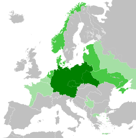
فائل:Greater German Reich (1942).svg

Size of this PNG preview of this SVG file: 450*456 پڪزلس. ٻيا تحلل:237*240 پڪزلس | 474*480 پڪزلس | 758*768 پڪزلس | 1,011*1,024 پڪزلس | 2,021*2,048 پڪزلس
اصلوڪو فائيل (ايسويجي فائيل، اٽڪل 450 × 456 عڪسلون، فائيل سائيز: 594 KB)


.svg)
.svg)
.svg)
.svg)
.svg)


.svg)
.svg)
.svg)


.png)
.png)


.svg)


.svg)

.svg)


.svg)
.svg)
.svg)
.svg)


.svg)
.png)


.svg)


.svg)
.svg)


.svg)


.svg)


.svg)
.svg)
.svg)
.svg)
.svg)
.svg)
.svg)
.svg)
_cropped.svg)
.svg)
.svg)
.svg)
.svg)
.svg)
.svg)
.svg)
.svg)
.svg)
.svg)
.svg)
.svg)
.svg)
.svg)
.svg)
.svg)
.svg)
.svg)
.svg)
.svg)
.svg)
.svg)
.svg)
.svg)
.svg)
.svg)
.svg)
.svg)
.svg)
.svg)
.svg)
.svg)
.svg)
.svg)
.svg)
.svg)
.svg)
.svg)
.svg)
.svg)
.svg)
.svg)
.svg)
.svg)
.svg)
فائيل جي سوانح
ڪنھن بہ تاريخ/وقت تي ٽڙڪ ڪري ڏسندا تہ ان وقت اهو فائيل ڪيئن هو.
.svg&dir=prev)
.svg&offset=20180422235102)
.svg&offset=&limit=20)
.svg&offset=&limit=50)
.svg&offset=&limit=100)
.svg&offset=&limit=250)
.svg&offset=&limit=500)
| تاريخ/وقت | آڱوٺي ننھن | ماپَ | واپرائيندڙ | راءِ | |
|---|---|---|---|---|---|
| موجود نسخو | 20:48, 20 مارچ 2023 | | 450 × 456 (594 KB) | Qbox673 | Reverted to version as of 07:51, 23 August 2020 (UTC) Please establish consensus on the talk page before changing. |
| 19:16, 19 مارچ 2023 |  | 450 × 456 (1.51 MB) | Daniilnihuya | Reverted to version as of 18:47, 22 August 2020 (UTC) | |
| 07:51, 23 آگسٽ 2020 |  | 450 × 456 (594 KB) | BOS2077 | Reverted to version as of 13:23, 28 July 2020 (UTC) | |
| 18:47, 22 آگسٽ 2020 |  | 450 × 456 (1.51 MB) | Terryfirut | Reverted to version as of 17:17, 5 July 2020 (UTC) | |
| 13:23, 28 جُولاءِ 2020 |  | 450 × 456 (594 KB) | Staberinde | Reverted to version as of 01:04, 24 April 2018 (UTC) restore old version, puppet states are not the same thing as occupied territory | |
| 04:12, 7 جُولاءِ 2020 |  | 450 × 456 (1.04 MB) | Croatianpotato | Reverted to version as of 22:35, 4 July 2020 (UTC) | |
| 17:17, 5 جُولاءِ 2020 |  | 450 × 456 (1.51 MB) | Hell - lllio | Winter Offensive Occupied Territory | |
| 22:35, 4 جُولاءِ 2020 |  | 450 × 456 (1.04 MB) | Hell - lllio | Vichy France (and its colonies) and Slovakia we're German Puppet States, so it should be Included in the Civilian Controlled Occupied Territories (Puppets) | |
| 01:04, 24 اپريل 2018 |  | 450 × 456 (594 KB) | TRAJAN 117 | +++ | |
| 23:51, 22 اپريل 2018 |  | 450 × 456 (594 KB) | TRAJAN 117 | +++ |
ڳنڍڻا
هن فائيل سان هيٺيان صفحا ڳنڍيل آهن.
گلوبل فائيل جو استعمال
ھيٺيون وڪيز بہ ھيءُ فائيل استعمال ڪن ٿيون:
- ar.wikipedia.org تي استعمال
- av.wikipedia.org تي استعمال
- az.wikipedia.org تي استعمال
- bbc.wikipedia.org تي استعمال
- bg.wikipedia.org تي استعمال
- cs.wikipedia.org تي استعمال
- el.wikipedia.org تي استعمال
- en.wikipedia.org تي استعمال
- es.wikipedia.org تي استعمال
- fr.wikipedia.org تي استعمال
- gn.wikipedia.org تي استعمال
- he.wikipedia.org تي استعمال
- hr.wikipedia.org تي استعمال
- hu.wikipedia.org تي استعمال
- id.wikipedia.org تي استعمال
- Jerman Nazi
- Daftar imperium terbesar
- Anschluss
- Wikipedia:Artikel pilihan/Jadwal/Usulan/2020
- Wikipedia:Artikel pilihan/Jadwal/Usulan/2020/Periode 3
- Wikipedia:Artikel pilihan/Jadwal/Usulan/2020/Periode 8
- Wikipedia:Artikel pilihan/Daftar artikel pilihan 2020
- Wikipedia:Artikel Pilihan/32 2020
- Wikipedia:Arsip halaman utama/2020/08/03
- Wikipedia:Arsip halaman utama/2020/08/04
- Wikipedia:Arsip halaman utama/2020/08/05
- Wikipedia:Arsip halaman utama/2020/08/06
- Wikipedia:Arsip halaman utama/2020/08/07
- Wikipedia:Arsip halaman utama/2020/08/08
- Wikipedia:Arsip halaman utama/2020/08/09
- Wikipedia:Artikel pilihan/Daftar artikel pilihan 2023
- Wikipedia:Artikel pilihan/Jadwal/Usulan/2023
ھن فائيل جو وڌيڪ گلوبل استعمال ڏسو.
.svg)
.svg)