فائل:United Kingdom adm location map.svg
Page contents not supported in other languages.
کليل ڄاڻ چيڪلي، وڪيپيڊيا مان

اصلوڪو فائيل(ايسويجي فائيل، اٽڪل 886 × 1,369 عڪسلون، فائيل سائيز: 703 KB)

ھي فائيل وڪيميڊيا العام مان آھي ۽ ٻين رٿائن پاران پڻ استعمال ٿي سگهي ٿو. تشريح انجي [فائيل جي تشريحي صفحي] ھيٺان ڏنل آھي.

تَتُ

تشريح
Deutsch: Positionskarte des Vereinigten Königreichs
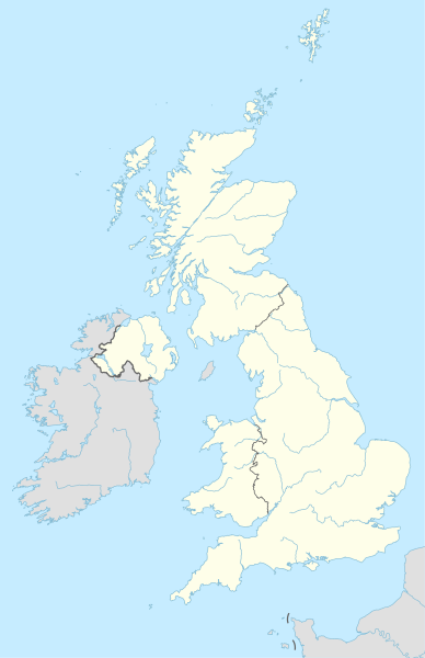
English: Location map of the United Kingdom

Equirectangular projection, vertical stretching 170 %
Border coordinates

61.0
-11.0←↕→2.2
49.0
 Info This map is part of a series of location maps with unified standards: SVG as file format, standardised colours and name scheme. The boundaries on these maps always show the de facto situation and do not imply any endorsement or acceptance. In case of changes of the shown area the file is updated. The old version will be uploaded as a new file and thus is still available.
تاريخ
ذريعو

Own work using:

  • United States National Imagery and Mapping Agency data

a. this product was developed using materials from the United States National Imagery and Mapping Agency and are reproduced with permission. b. this product has neither been endorsed nor authorized by the United States National Imagery and Mapping Agency or the United States Department of Defense.

  • World Data Base II data (public domain)
ليکڪ NordNordWest
Kartenwerkstatt
This map has been made or improved in the German Kartenwerkstatt (Map Lab). You can propose maps to improve as well.

لائيسنسڪاري

Usage of this file with:

explanatory notes: Legally binding is only the full legalcode. For a free usage I recommend to respect the following licence conditions:
1. Provide my name as given above: NordNordWest,
2. a copy of, or the URI for, the applicable license: https://creativecommons.org/licenses/by-sa/3.0/de/legalcode,
3. the title of the work,
4. in the case of an adaptation, a credit identifying the use of the work in the adaptation.
This license and the rights granted hereunder will terminate automatically upon any breach by you of the terms of this license. Any of the above conditions can be waived if you get permission from the copyright holder. If you have questions or wish differing conditions, please contact me through nnwest@t-online.de or my discussion page

w:en:Creative Commons
انتساب ھڪجھڙي ڀاڱيداري
This file is licensed under the Creative Commons Attribution-Share Alike 3.0 Germany license.
انتساب: Karte: NordNordWest, Lizenz: Creative Commons by-sa-3.0 de
توھان آزاد آھيو:
  • ونڊڻ لاءِ – اھو ڪم نقل ڪرڻ، ورڇڻ، ۽ پارمڪارڻ
  • جڳلبندي ڪرڻ – ڪم اختيار ڪرڻ لاءِ
ھيٺين شرطن تي:
  • انتساب – توهان لازماً مناسب انتساب ڏيو، اجازتنامي ڏانھن ڳنڍڻو مھيا ڪريو، ۽ جيڪڏھن ڪي تبديليون ڪيون ويون ھجن تہ انھن جي نشاندھي ڪريو. توهان اهو ڪري سگهو ٿا ڪنھن بہ معقول طريقي سان، پر ڪنھن بہ اھڙي طريقي سان نہ جيڪو ڏسي تہ اجازتنامو ڏيندڙ توهان جي يا توهان جي استعمال جي توثيق ڪري ٿو.
  • ھڪجھڙي ڀاڱيداري – جيڪڏھن توھان ٻيھر ملاوٽ، بدلاءُ، يا مواد تي اڏاوت ڪريو ٿا، توھان کي لازماً پنھنجون ڀاڱيداريون ساڳي يا موافق اجازتنامي جھڙو اصل جو ھيو، ھيٺ ٻيھر-ورھائڻ گهرجن.

عنوان

ھڪ-سٽي وضاحت ڏيو تہ ھي فائيل ڇاکي ٿو ظاھر ڪري
Location map of the United Kingdom

Items portrayed in this file

depicts انگريزي

Bredon انگريزي

copyright status انگريزي

copyrighted انگريزي

inception انگريزي

28 اپريل 2015

MIME type انگريزي

image/svg+xml

فائيل جي سوانح

ڪنھن بہ تاريخ/وقت تي ٽڙڪ ڪري ڏسندا تہ ان وقت اهو فائيل ڪيئن هو.

تاريخ/وقتآڱوٺي ننھنماپَواپرائيندڙراءِ
موجود نسخو20:13, 28 اپريل 201520:13, 28 اپريل 2015 جي نظرثاني لاءِ تصويري نشان886 × 1,369 (703 KB)NordNordWest== {{int:filedesc}} == {{Information |Description= {{de|1=Positionskarte des Vereinigten Königreichs}} {{en|1=Location map of the United Kingdom}} {{Location map series N |stretching=170 |top=61.0 |bottom=49.0 |left=-11.0 |right=2.2 }} |Source={{Own u...

هن فائيل سان هيٺيان صفحا ڳنڍيل آهن.

گلوبل فائيل جو استعمال

اعدادِ اعداد