
فائل:Districts and tehsils of Pakistan.png

هن پيش-نگاھ جي ماپ: 635*599 پڪزلس. ٻيا تحلل:254*240 پڪزلس | 509*480 پڪزلس | 814*768 پڪزلس | 1,085*1,024 پڪزلس | 1,496*1,412 پڪزلس
اصلوڪو فائيل (1,496 × 1,412 عڪسلون، فائيل سائيز: 76 KB، MIME ٽائيپ: image/png)

|
File:Map of Pakistan (2017).svg is a vector version of this file. It should be used in place of this PNG file when not inferior.
File:Districts and tehsils of Pakistan.png → File:Map of Pakistan (2017).svg
For more information, see Help:SVG. |
.svg) |
|
|
File:Map of Pakistan (2018).svg is a vector version of this file. It should be used in place of this PNG file when not inferior.
File:Districts and tehsils of Pakistan.png → File:Map of Pakistan (2018).svg
For more information, see Help:SVG. |
.svg) |
تَتُ
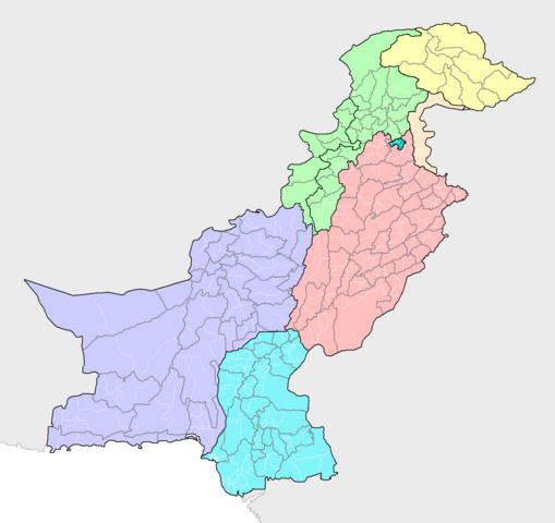
| تشريح | Map of the districts of Pakistan, with their constituent tehsils (thin white borders). Map includes the disputed areas. Created by Rarelibra 20:47, 31 October 2007 (UTC) for public domain use, using MapInfo Professional v8.5 and various mapping resources. |
| تاريخ | 31 آڪٽوبر 2007 (original upload date) |
| ذريعو | ڪم پنھنجايو |
| ليکڪ | Rarelibra |
لائيسنسڪاري
| I, the copyright holder of this work, release this work into the public domain. This applies worldwide. In some countries this may not be legally possible; if so: I grant anyone the right to use this work for any purpose, without any conditions, unless such conditions are required by law. |
فائيل جي سوانح
ڪنھن بہ تاريخ/وقت تي ٽڙڪ ڪري ڏسندا تہ ان وقت اهو فائيل ڪيئن هو.
| تاريخ/وقت | آڱوٺي ننھن | ماپَ | واپرائيندڙ | راءِ | |
|---|---|---|---|---|---|
| موجود نسخو | 21:16, 9 مَئي 2019 | | 1,496 × 1,412 (76 KB) | Milenioscuro | recolored, cut out leftover areas |
| 10:44, 13 جُونِ 2018 |  | 2,112 × 1,632 (110 KB) | Balti sahib | Added the districts of Northern Pakistan (G-baltista), also included Fata into KPK province as per administeratives changes because of Fata Reforms; which merged Fata into KPK province. | |
| 16:14, 8 آگسٽ 2010 |  | 2,112 × 1,632 (138 KB) | AnonyLog | Aksai Chin is not claimed by Pakistan; this is too complicated to have as currently represented. Also indicates to a newcomer to Pakistan that it administers all of J&K as one district!.. | |
| 13:03, 13 نومبر 2009 |  | 2,112 × 1,632 (142 KB) | Nomi887 | Added Disputed Kashmir Regions and also added colours for more clarity. | |
| 20:47, 31 آڪٽوبر 2007 |  | 2,112 × 1,632 (72 KB) | Rarelibra | Map of the tehsils of Pakistan. Map includes the disputed areas. Created by ~~~~ for public domain use, using MapInfo Professional v8.5 and various mapping resources. |
ڳنڍڻا
هن فائيل سان هيٺيان صفحا ڳنڍيل آهن.
گلوبل فائيل جو استعمال
ھيٺيون وڪيز بہ ھيءُ فائيل استعمال ڪن ٿيون:
- ar.wikipedia.org تي استعمال
- awa.wikipedia.org تي استعمال
- ba.wikipedia.org تي استعمال
- be-tarask.wikipedia.org تي استعمال
- bg.wikipedia.org تي استعمال
- bn.wikipedia.org تي استعمال
- bxr.wikipedia.org تي استعمال
- diq.wikipedia.org تي استعمال
- dty.wikipedia.org تي استعمال
- en.wikipedia.org تي استعمال
- fa.wikipedia.org تي استعمال
- gl.wikipedia.org تي استعمال
- hi.wikipedia.org تي استعمال
- incubator.wikimedia.org تي استعمال
- inh.wikipedia.org تي استعمال
- it.wikipedia.org تي استعمال
- ka.wikipedia.org تي استعمال
- lez.wikipedia.org تي استعمال
- mai.wikipedia.org تي استعمال
- ms.wikipedia.org تي استعمال
- new.wikipedia.org تي استعمال
- nl.wikipedia.org تي استعمال
- pa.wikipedia.org تي استعمال
- pnb.wikipedia.org تي استعمال
- ps.wikipedia.org تي استعمال
- pt.wikipedia.org تي استعمال
- ru.wikipedia.org تي استعمال
- simple.wikipedia.org تي استعمال
- tg.wikipedia.org تي استعمال
- tl.wikipedia.org تي استعمال
- uk.wikipedia.org تي استعمال
- ur.wikipedia.org تي استعمال
ھن فائيل جو وڌيڪ گلوبل استعمال ڏسو.